Sargeant: inReach Mini Helps to Stay Connected in the Outback
By Frank Sargeant, The Fishing Wire
One of the reasons I’m inclined to sneak off to places like the high-country trout streams of Colorado now and then is because if you get back in far enough, you’re off the grid—you’re no longer “connected”, and those clients whom I love so dearly because they put food on my table but hate so much because they frequently message me at 5 a.m. with jobs that have to be done “immediately if not sooner” cannot reach me.
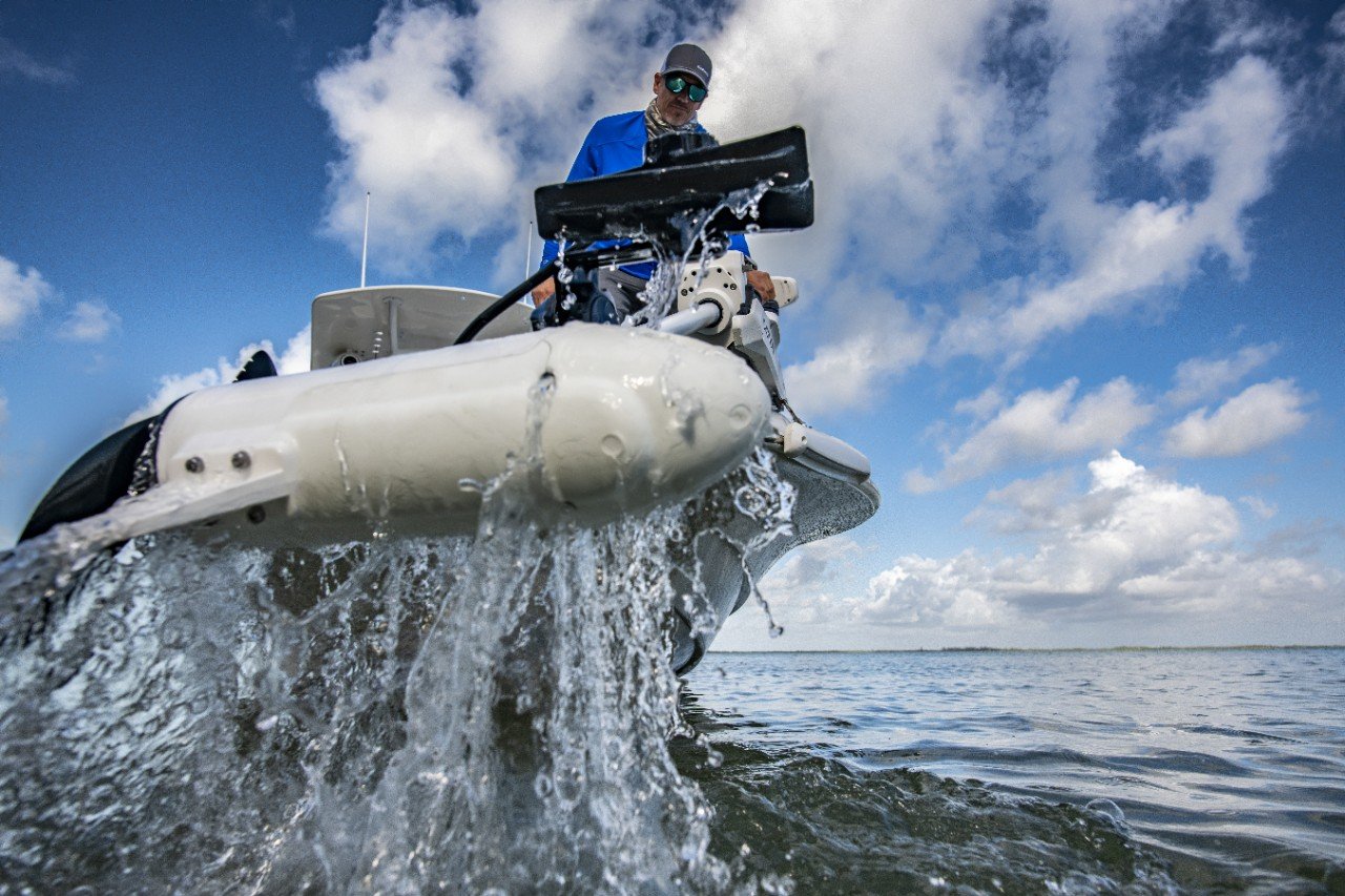
In a lot of mountain country, smartphones get stupid real quick anytime you get a few miles off the interstates. That’s a blessing, because it lets you immerse yourself in the country and the water and the fish. But it can also be a curse if you run into trouble and need help. And there are a lot of ways to get into trouble, not only in that vertical terrain but in big woods and on big water anywhere on the planet.
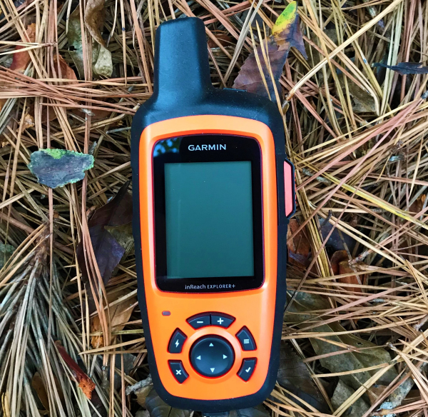
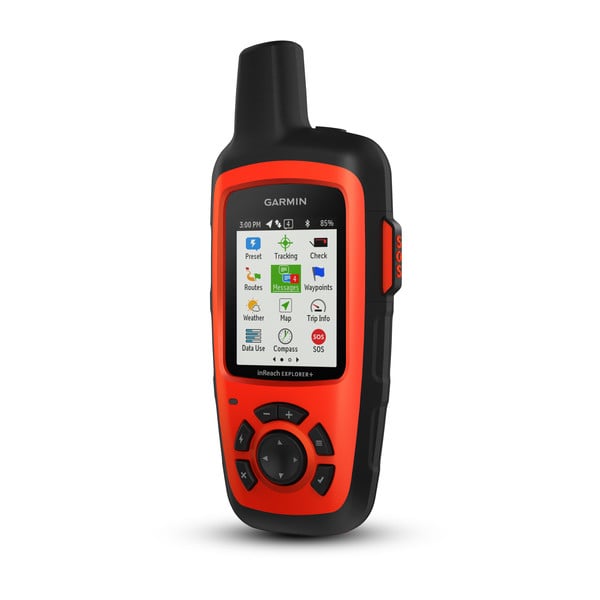
Garmin’s inReach Explorer+ is a cell-phone-sized global communicating device that can send out emergency messages successfully from anywhere on the planet.
Maybe you simply get stuck in the backcountry snow, or maybe you’re offshore and your boat begins taking on water, won’t start, runs out of gas — boats can think of lots of ways to cause trouble.
Simply getting lost is amazingly common, even among experts in backcountry travel. A couple of years back a friend of mine headed out on a solo elk hunt west of Kremmling, Colorado, found and killed his elk as he had every year for more than a decade—and then got turned around in a snowstorm on the way out carrying the first bag of meat. He hit a jeep trail the next day, after spending a freezing night in the mountains with no tent and no sleeping bag.
Also a concern in this steep terrain is falling, or being hit by falling rocks. For those who fish the streams, the slippery approaches to some canyon pools can be risky. And of course, there’s some risk from the critters that share the backcountry. Snakes are the major concern in warm weather, but there’s also some real though rare risk from the predators. Colorado has had four mountain lion attacks this year, and guides in some areas report black bears are homing in on rifle shots during the elk season and then claiming the carcasses, sometimes before the hunters are finished field dressing them.
Sometimes, the dangers come from within. Seven years ago this spring I took a break from chasing the bass on Lake Guntersville to chasing the turkeys in Skyline WMA, in northwest Alabama. Skyline is well-named: It’s the last vestige of the Appalachians, and it’s got a lot of steep hardwoods as well as some great flat-top strutting zones.
At first light, on opening morning, I heard a gobbler on one of these tops and started up to get within calling range. It’s rough, broken country, but you can go up most of it by scrambling rather than actually doing any rock climbing—elevation change can be up to 500 feet, from around 700 feet on the valley floor to 1200 on the tops—and you can bet the turkey you hear will always be up on the top when you’re down on the bottom.
About 15 minutes into the climb I noticed I was sweating a whole lot more than usual, even though it was a chilly morning, and a few hundred yards further on I suddenly had the urge to sit down, pronto. It felt like I was breathing molasses. The woods started spinning. At first, I thought I had downed a little too much caffeine on the drive to the woods, but after a few minutes I realized it was way more than that. I needed help. No cell phone service, of course — and no other way to get help.
I slid most of the way down on the foam pad of my turkey vest, stopping to let my breathing catch up every few yards. When I reached the truck I rested a few minutes, started up and drove myself home, where my wife took one look at me and drove me to the emergency room. Four days later I had robotic heart surgery in Birmingham. After a few months of rehab, I was good as new … make that better than new because it was a wakeup call — I changed my diet, cut salt, lost 15 pounds and started walking two miles a day. I was lucky, but many who have serious health complications in remote woods or waters without some way to call for help are not.
Bottom line is that you can get into a difficult situation anytime you get out of range of your communications system.
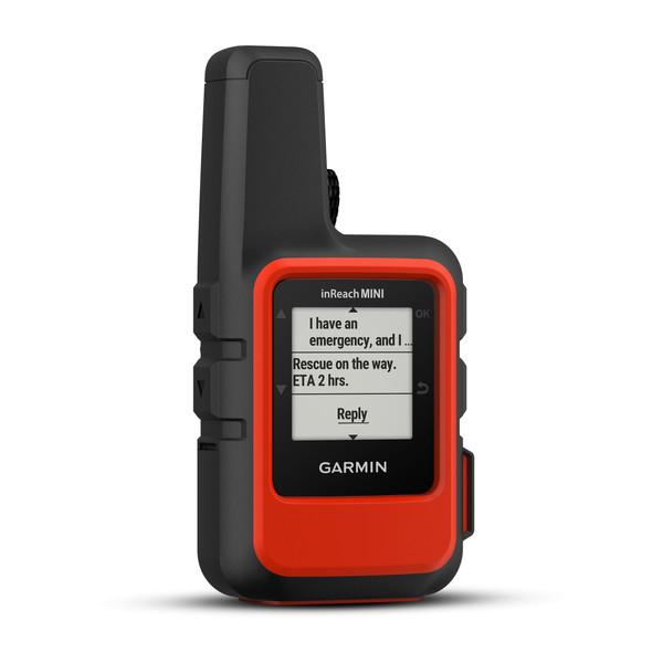
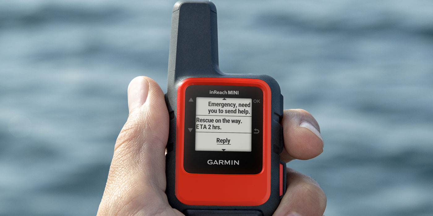
This is why specialized devices like Garmin’s inReach Explorer make a lot of sense for those who go off the grid. It’s what they call a “satellite communicator”, and like a handheld GPS, it can locate and map you anywhere on the globe via satellite signals. The difference is this device, about the size of a cellphone and weighing under eight ounces, also allows you to send and receive messages anywhere on the planet through satellites as well.
You can not only call for help, the primary purpose of a device like this, but you can also message a pre-selected set of family and friends to let them know what’s happening.
This opens up non-emergency uses as well — say you’re having such a wonderful grouper trip out on the continental shelf of the Gulf of Mexico that you decide to stay overnight — but you’ve told the family you’d be back by sundown. Because you can direct a message to those ashore, even though you’re far out of cell phone range, you can let them know you’re fine and will be back tomorrow.

Whether fishing the high Smokies for brookies or hiking to high-country lakes in the Rockies for rainbows, taking along an emergency satellite-communications device is smart — and could save your life.
The device includes a GPS mapping system with built-in sensors to provide a digital compass, barometric altimeter, and accelerometer, giving you pinpoint directional precision, and you can lay down tracks as you go so that finding your way back out is easy.
A free app pairs the tracker with your mobile device for access to premium topographic maps, aerial imagery, and U.S. NOAA charts, much easier to see on the larger screen of your phone — and these maps work even when your cellphone has no service. The internal, rechargeable lithium battery provides up to 100 hours of battery life in tracking mode and up to 30 days in power-save mode according to the manufacturer. (If it’s shut off, it lasts a really long time—months rather than days.) It’s solidly built and has a water resistance rating of IPX73, which means it can not only survive rain and snow but also being submerged up to 3 feet.
Needless to say if you’re experiencing a real emergency, you may not be coherent enough to type out any sort of a reasonable message with your thumbs on the mini-screen, but there’s a big fat SOS button on the side of the Explorer (under a cover so you don’t hit it accidentally) that when activated will immediately get the word out that you need help, pronto.
The alert goes to what’s known as GEOS — the Global Earth Observation System–which will send you a message asking the nature of your emergency, then contact the appropriate emergency responders. The system works in 140 countries including all of North America.
There is a price for all this, of course. In order for the emergency notification part of the features to function, you have to sign up for Iridium services, either by the month or by the year. I go into areas where I need the service in fall, in Colorado trout country, and in spring when I turkey hunt a number of mid-South mountain areas. The rest of the year, I might use the GPS function for an occasional off-trail hike but I don’t pay for the two-way communications. The monthly fee for basic service is $14.95, or $11.95 per month for a 12-month contract. You can select as many months or as few as you need with the monthly plan.