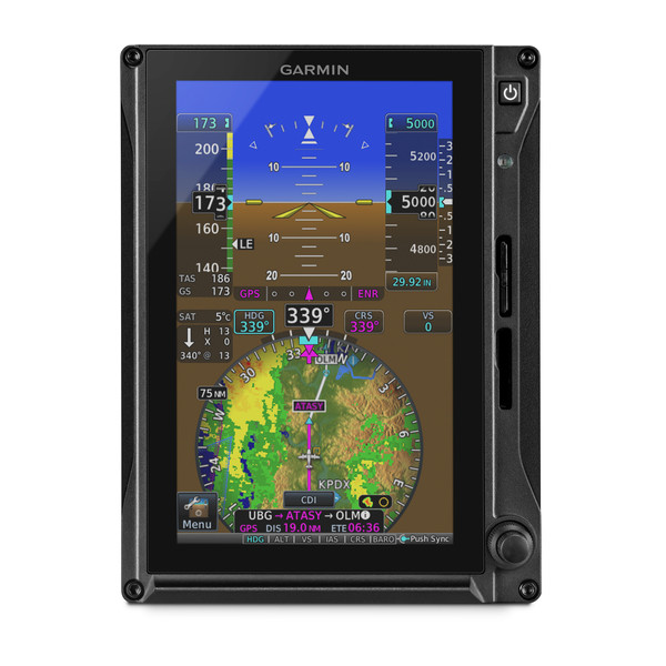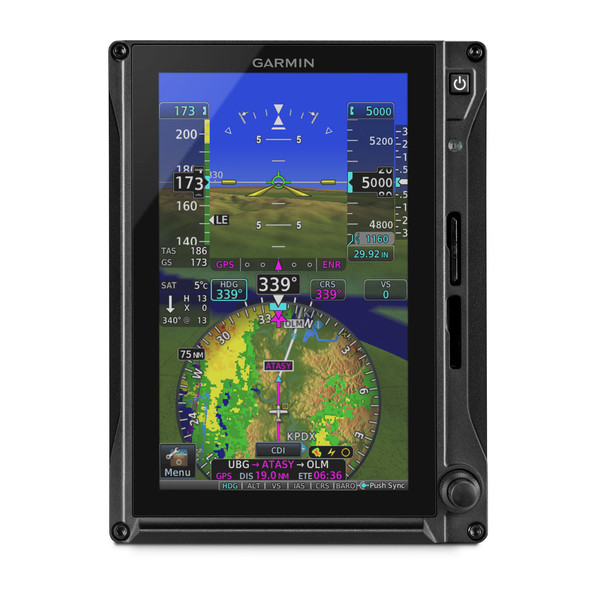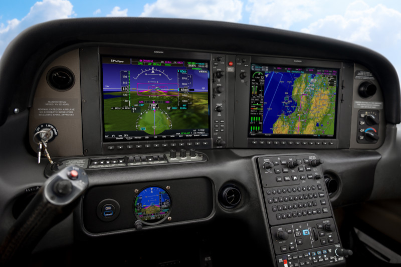
TXi Touchpoint: Not Your Average HSI
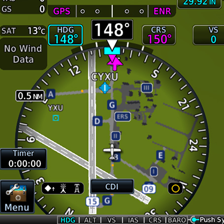
The horizontal situation indicator (HSI) commands a significant portion of a pilot’s attention throughout a flight, especially during instrument procedures. Your focus and attention are balanced between various instruments, processing information and deciphering data as you make decisions in the cockpit. A primary flight display that can concentrate this critical information within pilots’ primary field of view could help reduce workload and streamline actions during these critical phases of flight. We took this into consideration with our TXi flight display series and developed an HSI mapping feature that provides not only traditional heading information and course guidance, but also additional data overlays to enhance pilots’ situational awareness. This touch-interface, MFD-like map can present NEXRAD imagery and weather, as well as SafeTaxi® diagrams, traffic, terrain alerting and more.
Better understand the weather around you
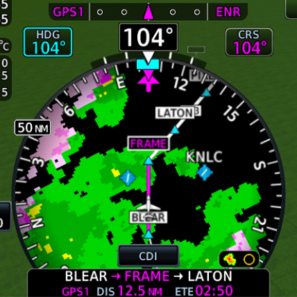
The TXi HSI map can overlay SiriusXM® Aviation Satellite Weather, ADS-B datalink weather or Doppler Radar, providing a better understanding of conditions and how they relate to your current position. For an added layer of weather information, Stormscope®, cell data and lightning strike information also can be viewed within the HSI map. Plus, it’s easy to zoom in for a closer look or zoom out for a ”higher-level” view of the conditions, simply swipe your finger up and down on the touchscreen HSI display.
ADS-B traffic targets
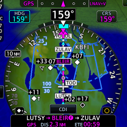
Also, keep an eye on surrounding ADS-B-equipped traffic. On aircraft properly equipped with select ADS-B solutions and a TXi series flight display, this dual-link position tracking feature allows you to see where an aircraft target is with respect to your own aircraft’s position within the HSI map. If a target gets too close, it changes to a highlighted yellow icon for added awareness.
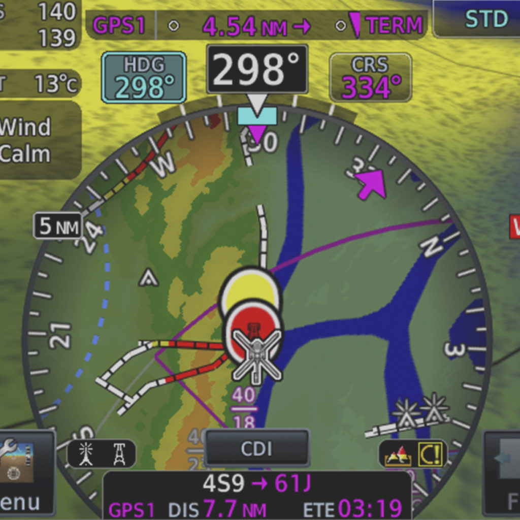
Terrain alerting
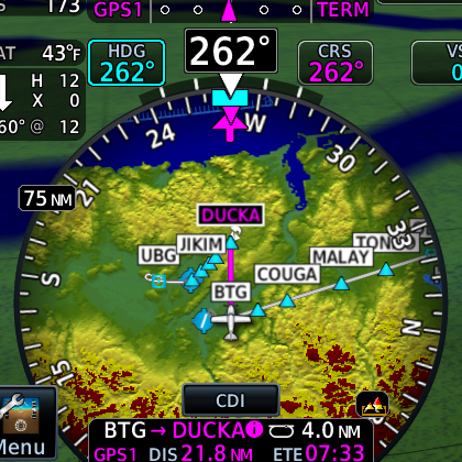
Hazardous terrain up ahead? The TXi HSI map presents the surrounding landscape in shades of green, yellow and red — from lowest risk to highest risk, respectively. If you’re approaching dangerous terrain, an alert will indicate the close proximity, helping the aircraft remain clear of hazards and on course.
Obstacles awareness
Stay apprised of obstacles along your flight path, like towers and buildings, while staying on course. Like terrain alerting, obstacles are displayed by degree of hazard — white indicating “no factor,” yellow to “be cautious” and red representing “danger.” As you approach dangerous obstacles, the indications become more distinct and pronounced, alerting pilots to take corrective action if necessary.
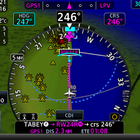
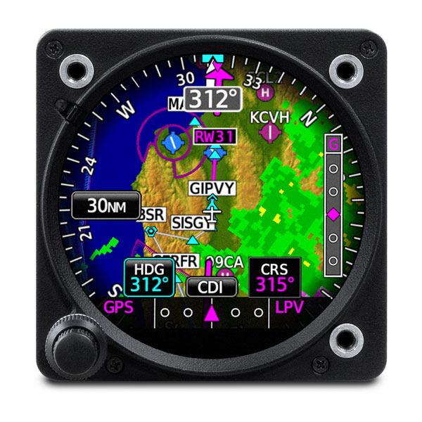
SafeTaxi airport navigation
We created SafeTaxi to help pilots navigate airports more easily. This tool displays a geo-referenced airport diagram and displays runways, taxiways and hangars relative to an aircraft’s location on the field. It also identifies hold short lines, providing pilots an even greater level of awareness to their location within the terminal environment.
WireAware™ and HTAWS for Helicopters
Helicopter pilots can benefit from the TXi HSI map too. Our G500H TXi for helicopters combines our WireAware wire-strike avoidance technology with optional HTAWS (Helicopter Terrain Awareness and Warning System) data to provide a comprehensive solution. It can help identify dangerous terrain and hazardous obstacle transmission (HOT) lines for the U.S. as well as some locations in Canada and Mexico.
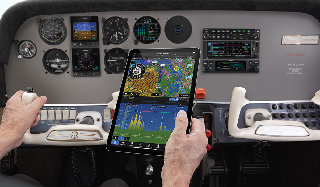
In addition to TXi series flight displays, select HSI mapping features and functions are available with G1000® NXi, G3000® and G5000® integrated flight decks, as well as our GI 275 electronic flight instrument. To learn more about our HSI map, and all of our safety-enhancing aviation solutions, visit Garmin.com/aviation.
Sirius, XM and all related marks and logos are trademarks of Sirius XM Radio Inc.
Stormscope is a registered trademark of L-3 Communications.