Garmin on Mars
When NASA’s Ingenuity helicopter took off for the first controlled flight on Mars, the Garmin LIDAR-Lite v3 optical distance measurement sensor helped measure how high the aircraft went.
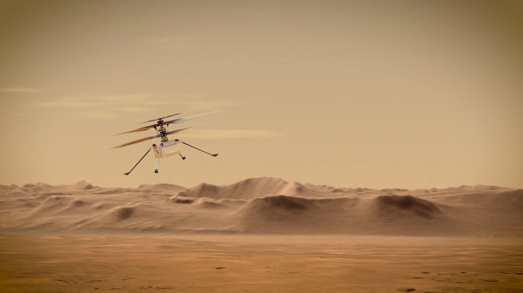
With the Ingenuity helicopter, NASA made the first controlled flight on another planet — and the history-making mission took place with Garmin on board.
Ingenuity landed safely at Jezero Crater on Mars on Feb. 18, 2021, attached to the belly of the Mars 2020 Perseverance Rover. It safely unfolded from its position on the rover, deployed to the Martian surface, charged using solar power, confirmed communications with flight operators on Earth, geared up the rotor blades and, finally, took off and flew autonomously for the first time. Ingenuity, originally designed for a technology demonstration of up to five test flights in 30 days, finished 72 flights in less than three years and completed its mission on Jan. 25, 2024.
So how was Garmin involved? Our technology, LIDAR-Lite v3, measured the distance from the helicopter to the ground. Ingenuity’s flight altitude goal was to get up to 15 feet (5 meters) from the surface of Mars for a flight lasting up to 90 seconds. To put this to scale, the atmosphere on Mars is less than 1% as dense as Earth’s — and that Wilbur and Orville Wright’s first flight on Earth only lasted for 12 seconds. Ingenuity did all that and more, ultimately flying for 128.8 minutes, covering 10.5 miles (17 kilometers) and climbing up to 78.7 feet high (24 meters).
Ingenuity weighed 4 pounds on Earth, equivalent to 1.5 pounds on Mars, and its rotors measured about 4 feet from tip to tip. This made LIDAR-Lite v3 the perfect compact, high-performance optical distance measurement sensor solution.
Below, Garmin design engineer Bob Lewis, who helped develop this technology, explains the advantages of choosing LIDAR-Lite on a mission as important as this.
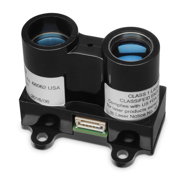
What is a LIDAR-Lite device, and how does it work?
The LIDAR-Lite module would be referred to as an altimeter. It measures the distance between the helicopter and the ground, and it uses infrared pulses of light that are projected down to the ground. Then the light returns, and it measures the time it takes for the light to propagate from the helicopter down to the ground and back up again. It was chosen because it’s very, very light, and the helicopter — because it’s operating in a low-density atmosphere — can’t carry a lot.
How is LIDAR-Lite typically used on Earth?
It’s used for measuring distance in different applications — typically distances of up to about 40 meters. And it’s pretty accurate. It’s accurate down to a little bit under an inch, so it’s useful in a variety of situations. It’s been used a lot in drones as an altimeter to measure the drone’s height off the ground. It’s been used in some robotics applications for scanning a room. One of the characteristics of this optical system is that it has a well-focused beam, so the beam doesn’t spread very much, and you can scan 360 degrees over the horizon and get a map for the room. But anywhere you’re trying to measure a distance accurately and with a fast update rate, LIDAR-Lite could be used for systems needing this information for navigation.
If you get an update rate that’s too slow, you can’t really move quickly. LIDAR-Lite can provide updates at hundreds of cycles per second.
Does Garmin have other products that use LIDAR-Lite technology?
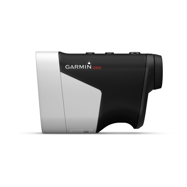
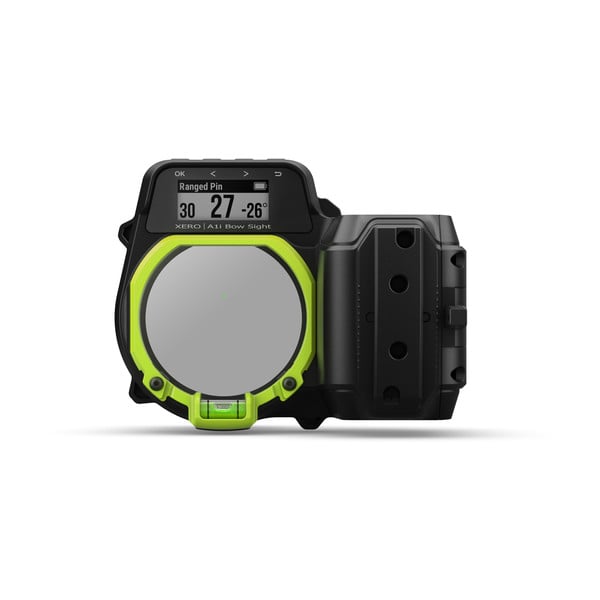
It’s actually used in a variety of Garmin products. In NASA’s case, I suspect it’s primarily used for measuring distance off the ground, but if you combine the distance to the ground with the camera system, you can use that for navigation. We have a handheld golf rangefinder, the Approach® Z82, that has that technology. There are also sportsman products, the Xero® A1i Bow Sight and the Xero X1iCrossbow Scope, that measure the distance to a target, and based on how far away you are, it will calculate how much airdrop there’s going to be. So if you’re 50 yards away, that arrow is going to drop quite a bit — and LIDAR-Lite basically gives you a new pointing location that compensates for that difference. It can be used in all kinds of unique applications.
Interested in reading more about this historic adventure? You can learn more about NASA’s Ingenuity mission here.