Latest g3 Marine Cartography Refresh Features More than 400,000 Updates
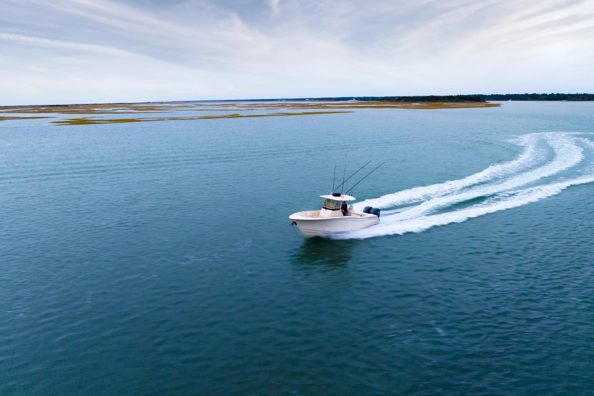
To maintain our status as the No. 1 world leader in marine mapping coverage1, the Garmin team is constantly working to improve our cartography. We consider it our responsibility to help you fulfill your responsibility as a safe boater, which is to maintain situational awareness on the water at all times. It is critical to understand the conditions around you and how those conditions affect your vessel so you can enjoy a safe and enjoyable day on the boat — which is why you’ll want to waste no time in securing the latest BlueChart® and LakeVü cartography update.
What’s included in the new g3 cartography update?
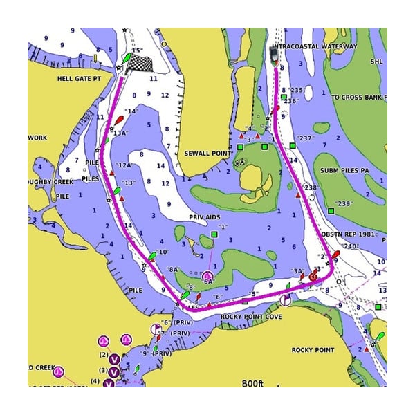
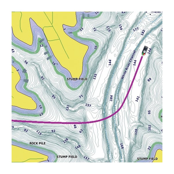
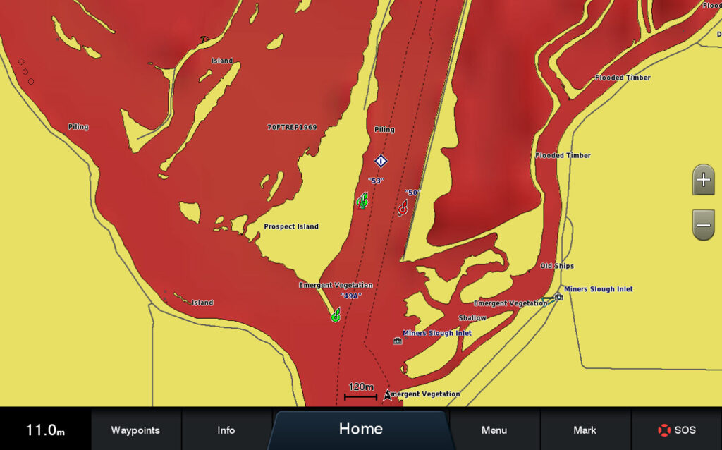
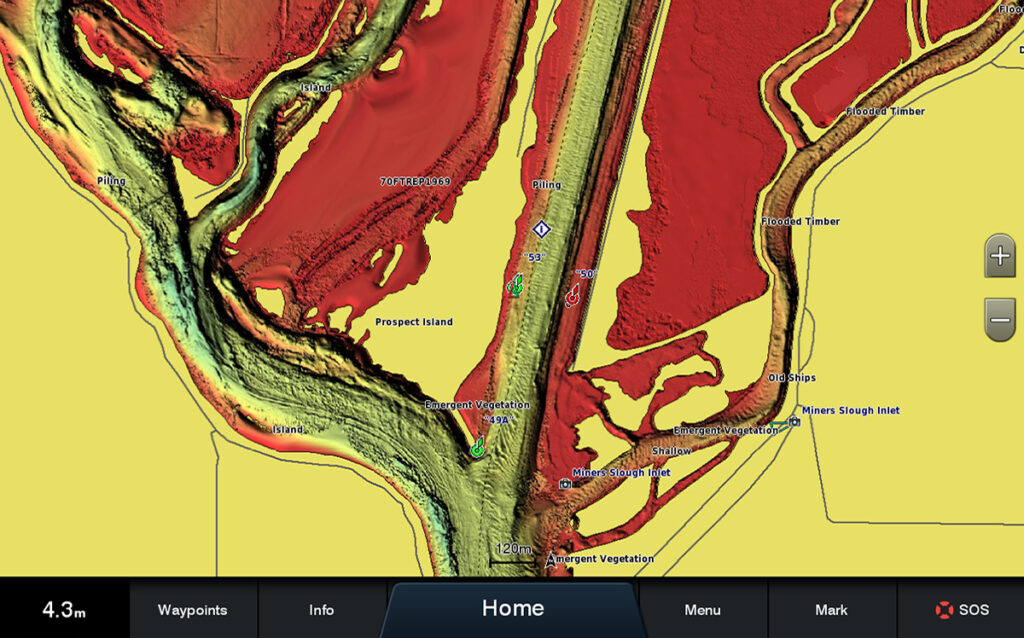
The latest g3 cartography release, v2022.0, includes more than 400,000 updates to global chart content, NOAA rasters, high-resolution relief shading, new survey lakes and more. Relief shading is a preloaded feature in the U.S. for BlueChart® g3 Vision and LakeVü g3 Ultra, which uses a blend of color and shadow to create a multidimensional view of the bottom structure. It has been improved in coastal areas in the U.S. as well as various regions in Europe, Australia and New Zealand. New survey data and sonar imagery has also been added for lakes across the globe, bringing the total Garmin- and Navionics-covered lake count to more than 41,000.
To access your updated charts, use the ActiveCaptain® app on your phone or tablet to download your update. Then connect wirelessly to transfer the updated charts to your Garmin chartplotter — it’s as simple as that. Don’t have the ActiveCaptain app yet? Download it here: www.garmin.com/activecaptainapp.
1Based on 2020 sales