How Garmin mapping options can help you explore the outdoors
With maps on Garmin GPS smartwatches, handhelds and more, you’ll be able to navigate the outdoors — no matter how you want to explore.
When you head out on a new outdoor adventure, you want to focus on the beauty of nature, the sound of the wind in the trees and the crunch of leaves beneath your feet. You don’t want to worry about getting lost or sidetracked.
That’s where Garmin outdoor maps come in. Beyond guiding the way, Garmin outdoor maps offer rich mapping detail, fresh location data and help give you peace of mind, allowing adventurers to disconnect from the digital noise while staying connected to their Garmin device of choice.
When you’re packing for your next outdoor adventure, consider packing a Garmin GPS handheld, wearing a GPS smartwatch and carrying a satellite communicator1 for added peace of mind.
Whether you love hiking, running or cycling out on the trails — or if you’re into hunting, diving, fishing or any other outdoor pursuit — Garmin has a mapping solution to elevate your outdoor adventure.
Explore with confidence
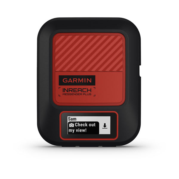
Before you go exploring, make sure to grab your inReach® Mini 2 or inReach Messenger Plus1. These products allow you to trigger an interactive SOS message to Garmin Response℠, our international emergency response coordination center that’s staffed 24/7. You’ll also get two-way messaging. With inReach Messenger Plus, you’ll even be able to exchange photos and voice messages2. These devices can last for weeks because of the durable design and long battery life.
Why navigate with Garmin smartwatches?
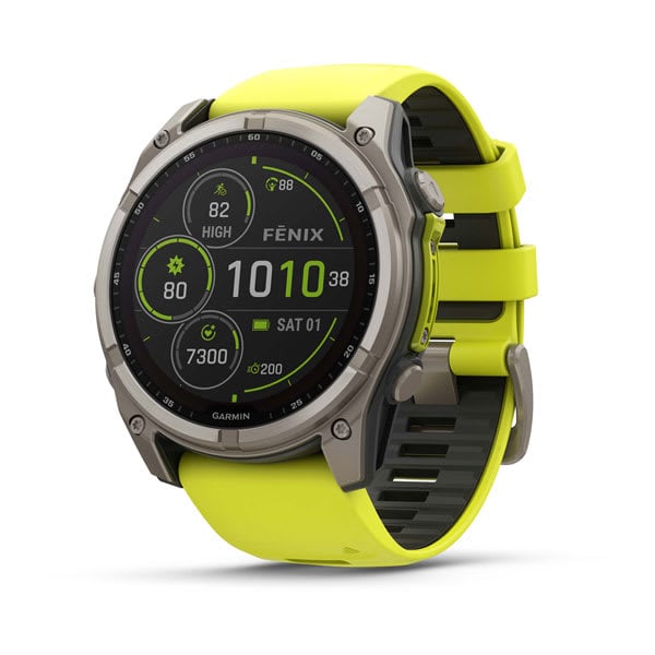
Garmin outdoor watches, including the fēnix® 8 – 51 mm, AMOLED premium GPS smartwatch and the Enduro™ 3 ultraperformance smartwatch, include a plethora of navigation features to meet your mapping needs. Watches like these include a built-in altimeter, barometer and 3-axis electronic compass. Plus, SatIQ™ technology and multi-band GPS help provide superior positioning accuracy.
You can get turn-by-turn directions when you create or use an existing course in the Garmin Connect™ app and sync it to your watch. Use the NextFork™ map guide to help navigate and see how far you are from the next trail intersection. With the Up Ahead feature, you’ll be able to see upcoming course points.
These smartwatches offer long battery life and rugged designs built for your next expedition. Plus, when you wear your watch 24/7, you’ll get a variety of health and wellness metrics3 you can use to train for your next outdoor adventure.
Why navigate with Garmin GPS handhelds?
With a durable Garmin handheld GPS navigator, you can track your location and go longer than before on your hike.
A stand-alone navigation product such as the versatile Montana® 710 series handheld GPS navigator gives you an easy-to-view and glove-friendly touchscreen display that will guide you through your adventures. This series offers multi-GNSS support, built-in navigation sensors (including an altimeter, barometer and 3-axis electronic compass), up to 440 hours of battery life in expedition mode and more.
It also has optional inReach1 technology, so it can help give you peace of mind when exploring without a cellphone signal.
Maps for hiking and trail running
Do you love hiking or trail running? Maybe both? Take outdoor mapping to the next level with TopoActive maps, Garmin Trails or Outdoor Maps+.
TopoActive topographic maps are preloaded on Garmin outdoor products such as the fēnix smartwatches and rugged GPS handhelds, including the GPSMAP® 67 series or the Montana 710 series. Available with multiple options worldwide, TopoActive maps provide road-routable maps with turn-by-turn guidance4 to your destination.
TopoActive maps feature details for summits, national parks, coastlines, lakes and more — along with points of interest of all kinds, including streets, trails and shops. These multiuse maps, based on the community-generated OpenStreetMap™ database4, are optimised specifically for outdoor activities.
If you’re looking for even higher detail in your maps, then activating an Outdoor Maps+ plan5 could be right for you. This premium mapping option allows you to explore freely by selecting from a variety of map layers for enhanced topo maps and more. You also get access to loads of adventure features, hunting and marine features, high-resolution satellite imagery, high-definition relief shading, detailed raster maps and more.
Once you subscribe, you’ll be able to access your Outdoor Maps+ plan on the Garmin Explore™ app, Alpha or Tread apps as well as on compatible smartwatches, handhelds and navigators.
Plan your perfect route for hiking, trail runs or backpack trips with Garmin Trails, available in select areas via the Garmin Explore and Garmin Connect™ apps. Depending on the length, level of difficulty, estimated completion time, and both descent or ascent total you are looking for, you can find a trail that fits your adventure.
With an Outdoor Maps+ or Garmin Connect+™ plan, send your trail directly to your compatible device. Navigate with confidence when you add points of interest and edit your paths.
Maps for cycling
Garmin has mapping options and a variety of mapping features for cyclists around the world. With a compatible Garmin Edge® device, cyclists can get preloaded, routing-capable maps for cycling with searchable points of interest, turn-by-turn directions and ride-specific mapping. The Garmin Edge 550 and 850 cycling computers come with preloaded mapping and Trailforks trail content — looking at you, mountain bikers — so you can be on the lookout for routes and trail details from anywhere that suits your needs. What’s more, with the Edge 550 and 850, you can add, swap or update maps for free from any of our global maps via Wi-Fi® on your device.
Maps for hunting
You bet we also have mapping capabilities for those who love to hunt. Know the lay of the land with an Outdoor Maps+ subscription, available in the Alpha app and compatible hunting devices, which comes with parcel maps, public land maps and hunting units, satellite imagery and more for all 50 states. Or you can select Garmin HuntView™Plus maps, featuring similar content that’s sold by state and can be downloaded or purchased as a preloaded SD™ card.
Maps for skiing
Ready to hit the slopes with Garmin? Enhance your situational awareness with the SkiView™ resort maps on compatible Garmin devices. With more than 2,000 preloaded ski resorts worldwide, you can view run names and difficulty ratings — all viewable at a glance for each run. Bundle up with a new sense of clarity at your favorite ski resort’s slopes.
Maps for golfing
Are you looking for a new excuse to set up a tee time? With a compatible Garmin golf watch, gain access to more than 43,000 preloaded, full-color CourseView golf maps. So go ahead: Set that tee time and hit ’em straight.
Maps for diving
Don’t let your adventures be confined to land. If you’re taking a deep dive into the ocean, you’ll be glad to have DiveView™ maps at your disposal — available with the Garmin Descent™ Mk3i dive computer and the Descent X50i premium dive computer. With more than 4,000 dive sites in coastal waters, preloaded DiveView maps with bathymetry allow divers to discover and learn new dive spots right on their wrists before their dives. This transparent map layer is overlaid on existing TopoActive regional maps.
Looking for specific dive spots like a shipwreck or a spearfishing hot spot? With DiveView maps, view detailed color maps of bathymetric depth contours and understand the underwater terrain you’re exploring.
Maps for boating
Whether you’re boating on your favorite lake or exploring salt waters, we have top-tier marine mapping options for your boat.
If you own a Garmin chartplotter such as the GPSMAP® 9000 series or the ECHOMAP™ Ultra 2 series, you can get Garmin Navionics+™ charts built in for detail-rich marine mapping with coastal and inland coverage, access to daily updates and more. And you have the option to upgrade to Garmin Navionics Vision+™ for even more mapping benefits. It is the #1 name in marine mapping6 for a reason.
Maps for off-road
Adventures taking you off-road? If you’re roaming the unknown on dirt or sand, consider exploring with the rugged Tread® 2 off-road navigator or zūmo® XT2 motorcycle satellite navigator. It features a glove-friendly and ultrabright touchscreen, turn-by-turn navigation4 for unpaved roads and trails with trail difficulty ratings in off-road riding areas, plus Adventure Roads and Trails, topographic maps and more.
Take Garmin everywhere
With Garmin your mapping solutions go wherever you do, seamlessly integrating with your favorite devices. Whether you’re traversing mountain trails or sailing the open seas, prepare for your outdoor adventure by browsing our collection of GPS handhelds and rugged outdoor watches.
Check out a blog about outdoor essentials, from navigation to shelter, before you hit the trails.
1Active satellite subscription required. Some jurisdictions regulate or prohibit the use of satellite communication devices. It is the responsibility of the user to know and follow all applicable laws in the jurisdictions where the device is intended to be used.
2Jurisdiction restrictions may apply; requires active inReach subscription and paired smartphone. Photo and voice messaging requires use of the Garmin Messenger™ app on your compatible smartphone.
3See Garmin.com/ataccuracy
4Limitations may exist in map data for some road and trail route suggestions. Always defer to all posted road signs and conditions during vehicle operation. Garmin products using OpenStreetMap data are intended to be used only as supplementary travel aid.
5Always defer to official sources because this information may not be up to date. This information is not available for every LTE service provider or every geographical area.
6Based on 2024 reported sales
OpenStreetMap is a trademark of the OpenStreetMap Foundation and is used with their permission. This product is not endorsed by or affiliated with the OpenStreetMap Foundation.
Wi-Fi is a registered trademark of the Wi-Fi Alliance.
Satellite Imagery © 2025 Maxar Technologies (date of satellite imagery may vary).