
Garmin’s Touchscreen aera reinvents the Fly-Drive experience
Garmin the global leader in satellite navigation is pleased to announce the launch of aera 500 and aera 550 – two new aviation handhelds that are touchscreen, rugged and multi-modal, transitioning between aviation to automotive mode with one touch.
These units have unprecedented ease of use that is derived from Garmin’s 20 years of expertise in the aviation and automotive markets. The aera series builds on the most popular features from earlier aviation models such as the 296 range and the renowned automotive nüvi range.
“Customers who use Garmin products in their plane and car have often asked us to create an all-in-one GPS that combines our aviation expertise with the operational simplicity and clean exterior design of our automotive devices,” said Gary Kelley, Garmin’s vice president of marketing.
“Since Garmin is vertically integrated we do nearly everything in-house. We have been able to meet our customers’ needs by leveraging the best features of our consumer and aviation technologies. The aera series will appeal to those who need a low cost, high quality, aviation handheld that is simple to use and multifunctional.”
In the air
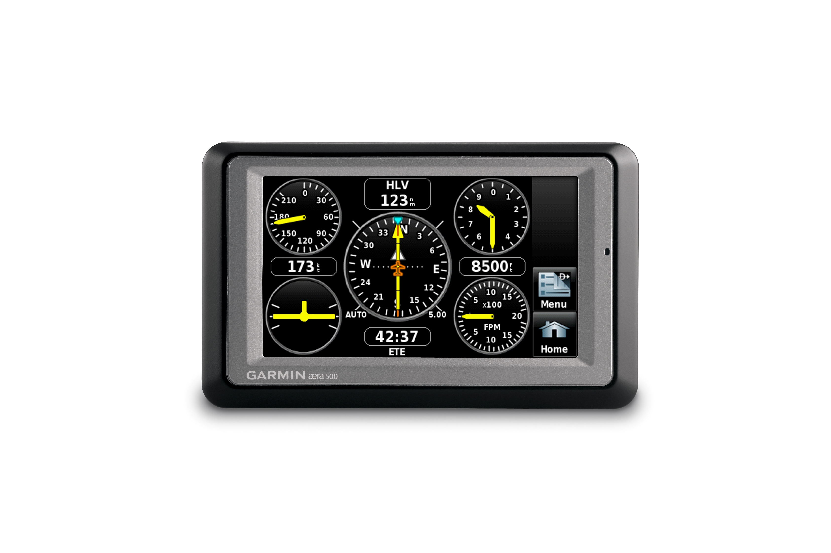
The aera series is Garmin’s first ever touchscreen aviation device, it has a 4.3 inch QVGA sunlight readable display with large, easy-touch icons. When in aviation mode, pilots are greeted with 10 menu option icons that use intuitive pictures and labels to indicate their function: map, terrain, HSI/panel, nearest, numbers, active FPL, WPT info, direct to, position and tools – including VNAV and User WPT. Pilots can choose any of these functions by simply tapping the appropriate icon. For example, after touching the terrain icon, pilots will see terrain and obstacle data that vividly depicts potential hazards.
Aesthetically the aera 500 and 550 are identical, but the software features of each model are tailored to those seeking an entry or mid-level aviation handheld.
The aera series also has a Smart Airspace function, which highlights airspace at and immediately surrounding your current altitude. Pilots can also get terrain warning alarms that sound to alert the pilot of their surroundings.
Pilots can keep track of and renew the databases on their aera device through fly.garmin.com – a website that helps pilots manage Garmin database information and dramatically simplifies the process of updating and purchasing aviation databases such as obstacles and terrain.
After logging onto fly.garmin.com, the home page gives a quick synopsis of the owner’s registered products and whether or not the databases are current. If a database needs to be updated, users can purchase one-time downloads or annual subscriptions directly from the site and install the database in three easy steps. Fly.Garmin.com eliminates the hassle of “unlock codes.” Those who have purchased the aera 550 will receive one year complimentary aviation database updates for obstacles, terrain and NavData.
On the road
Customers can easily change from aviation to automotive mode by pressing the airplane icon at the top of the aera’s screen or simply placing the aera in an automotive mount. In the automotive mode, customers will see the same “Where to?” and “View map” interface found on Garmin nüvi® and zūmo® products.
The rugged and waterproof (IEC 529 IPX-7 standards) aera series comes loaded with detailed, street-level maps of Europe. For those who prefer two wheels over four, the aera is also compatible with Garmin’s zūmo 660 motorcycle mount.
The aera allows for quick searches of street addresses and millions of preloaded points of interest such as petrol stations, hotels, restaurants, attractions, ATMs and more. In automotive mode, the drivers will receive turn-by-turn, voice prompted directions and spoken street names through the aera’s built-in speaker, such as “turn right on Main Street.” If they miss a turn, the aera automatically recalculates a route and gets them back on track.
The aera 550 comes equipped with advanced routing capabilities including lane assist with junction view, so drivers will see a realistic presentation of road signs and junctions along the route, as well as arrows that indicate the proper lane for navigation. These features make it easy to navigate unfamiliar junctions and motorway exits because the aera guides drivers to the correct lane for an approaching turn. Automotive map data is provided by NAVTEQ™ – a world leader in premium-quality mapping.
All aera products also have Bluetooth® Wireless Technology that makes it possible to receive and place phone calls directly from the aera while in automotive mode. It can be paired with over 200 Bluetooth enabled phones and a driver can retrieve and dial numbers using a supported phone’s contact list, the phone’s call history log, or the aera’s preloaded points of interest database.
The aera 500 and aera 550 will be available from mid-November. The Aera 500 will be available for an expected street price of $799 and the recommended pricing of the Aera 550 is yet to be confirmed. Additional information about the aera is available at www.garmin.co.uk
About Garmin
The global leader in satellite navigation, Garmin Ltd. and its subsidiaries have designed, manufactured, marketed and sold navigation, communication and information devices and applications since 1989 – most of which are enabled by GPS technology. Garmin’s products serve automotive, mobile, wireless, outdoor recreation, marine, aviation, and OEM applications. Garmin Ltd. is incorporated in the Cayman Islands, and its principal subsidiaries are located in the United States, Taiwan and the United Kingdom. For more information visit Garmin's media centre at www.garmin.co.uk/mediacentre. Garmin is a registered trademark of Garmin Ltd. or its subsidiaries. All other brands, product names, company names, trademarks and service marks are the properties of their respective owners. All rights reserved.
Notice on forward-looking statements:
This release includes forward-looking statements regarding Garmin Ltd. and its business. All statements regarding the company’s future product introductions are forward-looking statements. Such statements are based on management's current expectations. The forward-looking events and circumstances discussed in this release may not occur and actual results could differ materially as a result of known and unknown risk factors and uncertainties affecting Garmin, including, but not limited to, the risk factors listed in the Annual Report on Form 10-K for the year ended December 29, 2007 filed by Garmin with the Securities and Exchange Commission (Commission file number 000-31983). A copy of Garmin’s Form 10-K can be downloaded at www.garmin.com/aboutGarmin/invRelations/finReports.html. No forward-looking statement can be guaranteed. Forward-looking statements speak only as of the date on which they are made and Garmin undertakes no obligation to publicly update or revise any forward-looking statement, whether as a result of new information, future events, or otherwise.
xxxx