Complete coverage of the Republic of Ireland available with Garmin Eire Discoverer
Garmin Eire Discoverer is the latest in the mapping range, offering full coverage of the Republic of Ireland.
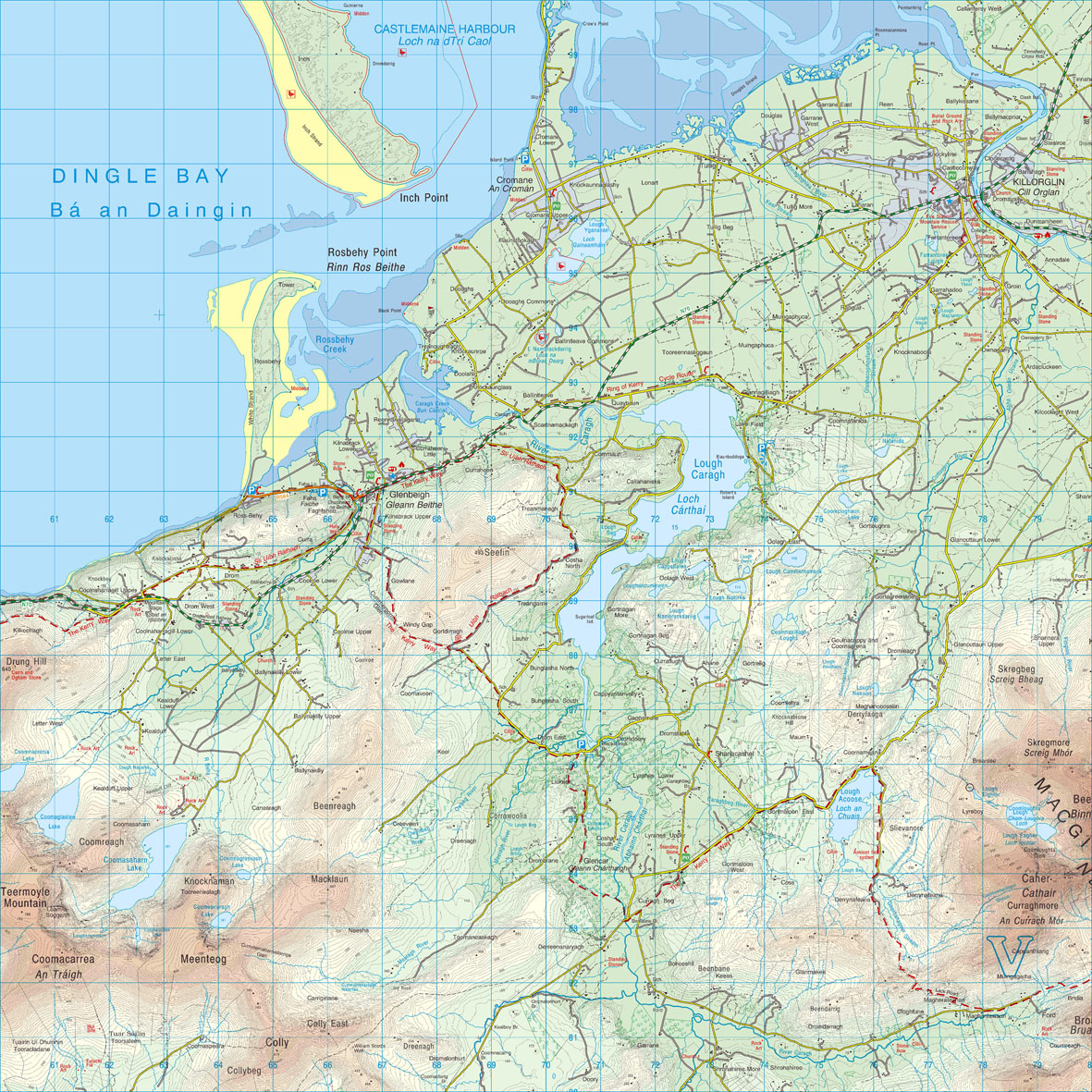
These revolutionary new maps bring outdoor enthusiasts the opportunity to view a wider variety of highly detailed mapping from the Ordnance Survey of Ireland (OSi) map series, whilst navigating with turn-by-turn accuracy on the road network.
Users can now benefit from full 1:50K scale Ordnance Survey of Ireland map coverage for the whole of the Republic of Ireland. Garmin Eire Discoverer is available in four regions – North West, North East, South West and South East.
Garmin Eire Discoverer allows users of theDakota™, Oregon® and Colorado® handhelds to experience using raster mapping with the underlying intelligence of vector cartography, providing navigation with ease and accuracy.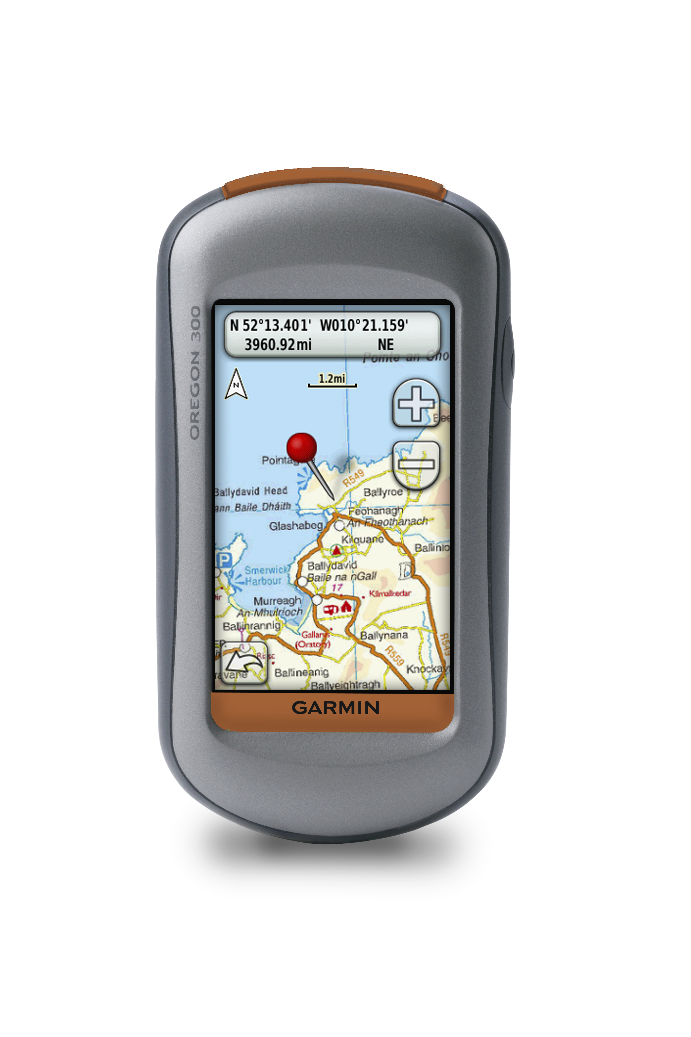
Garmin’s new mapping offers all the benefits of traditional paper maps with the added bonus of intelligent street map routing and interactive points of interest. Use the Garmin touchscreen GPS to search, select and navigate to street addresses and attractions, follow routes on foot, in car or by bike.
Product Manager for Outdoor Andrew Silver commented: “The popularity of our GPS handheld devices in Ireland has led to the innovation of mapping with the familiar Ordnance Survey of Ireland platform.
“For the first time in the Republic of Ireland handheld GPS devices can display information from Ordnance Survey of Ireland maps whilst giving you all the benefits of a Garmin GPS system.”
Providing an extensive database of points of interest (POIs) and available either via download or on a convenient microSD™/SD™ card from the Garmin website, you can simply insert the maps into Dakota, Oregon and Colorado devices and go.
Andrew added: “From placing the handheld in your car and using it to navigate to your chosen destination, to exploring footpaths and discovering your nearest camp site or restaurant, the combination of Ordnance Survey of Ireland mapping and a Garmin handheld GPS provides a completely interactive experience.”
Hugh Mangan at Ordnance Survey of Ireland said: “Working in Partnership with Garmin to produce new topographic maps has added a new perspective to OSi maps – the accuracy and detail from our most popular mapping is now provided with a GPS companion, helping you get a completely new and interactive map reading experience.”
Garmin Eire Discoverer is expected to be available from mid November 2009. For more information on Garmin Eire Discoverer mapping and the Garmin range of handheld GPs products visit www.garmin.co.uk
Eire Discoverer microSD/SD card RRP inc. VAT
North West €159.99/ £129.99
North East €159.99/ £129.99
South West €159.99/ £129.99
South East €159.99/ £129.99
* Purchase price applies to in-store only.
About Garmin
The global leader in satellite navigation, Garmin Ltd. and its subsidiaries have designed, manufactured, marketed and sold navigation, communication and information devices and applications since 1989 – most of which are enabled by GPS technology. Garmin’s products serve automotive, mobile, wireless, outdoor recreation, marine, aviation, and OEM applications. Garmin Ltd. is incorporated in the Cayman Islands, and its principal subsidiaries are located in the United States, Taiwan and the United Kingdom. For more information visit Garmin's media centre at www.garmin.co.uk/mediacentre. Garmin is a registered trademark of Garmin Ltd. or its subsidiaries. All other brands, product names, company names, trademarks and service marks are the properties of their respective owners. All rights reserved.
Notice on forward-looking statements:
This release includes forward-looking statements regarding Garmin Ltd. and its business. All statements regarding the company’s future product introductions are forward-looking statements. Such statements are based on management's current expectations. The forward-looking events and circumstances discussed in this release may not occur and actual results could differ materially as a result of known and unknown risk factors and uncertainties affecting Garmin, including, but not limited to, the risk factors listed in the Annual Report on Form 10-K for the year ended December 29, 2007 filed by Garmin with the Securities and Exchange Commission (Commission file number 000-31983). A copy of Garmin’s Form 10-K can be downloaded at www.garmin.com/aboutGarmin/invRelations/finReports.html. No forward-looking statement can be guaranteed. Forward-looking statements speak only as of the date on which they are made and Garmin undertakes no obligation to publicly update or revise any forward-looking statement, whether as a result of new information, future events, or otherwise.
About Ordnance Survey Ireland
Ordnance Survey Ireland is the national mapping agency for the Republic of Ireland, providing the most accurate and up-to-date geographic data, relied on by government, business and individuals. Ordnance Survey Ireland, the OSi Symbol and 1:50,000 Discovery are registered trademarks of Ordnance Survey Ireland.