Navigating Isolation and Extreme Weather in British Columbia with inReach
David Byng and his family spent 2 weeks exploring British Columbia’s beautiful northern wilderness. They had to navigate extreme weather, isolation, wildlife, and ultimately, a trip-ending blizzard. He shared the story with Garmin.
By David Byng
On Oct. 9, 2021, 1,765 kilometers of driving and one ferry ride later, we descended off Hwy 37 down the gravel access road to Klappan Air Service’s base at “Mountain Shadow,” Spatsizi River Outfitters lodge on Kluachon Lake. My wife Cheryl, son Max and his girlfriend Tami had joined me for a 2-week adventure exploring some of British Columbia’s most isolated northern wilderness.
Kluachon Lake is situated between Mount Edziza and Spatsizi Plateau Wilderness Provincial Park, deep within the traditional territory of the Tahltan Nation. The lake’s southern reaches are adjacent to the village of Iskut in northern British Columbia, Canada, peopled primarily by members of the Iskut First Nation.
Upon our arrival, low clouds and squalls of driving rain obscured the surrounding mountains that bordered the Klastline Plateau to the southwest. The day’s pervasive high winds and successive storm systems erased any possibility of flying along the Klappan River and through the Stikine Range to our destination on the Spatsizi Plateau in the vicinity of the Sacred Headwaters. The Sacred Headwaters include the origins of the Skeena, Nass and Stikine Rivers, some of western North America’s most important salmon producers.
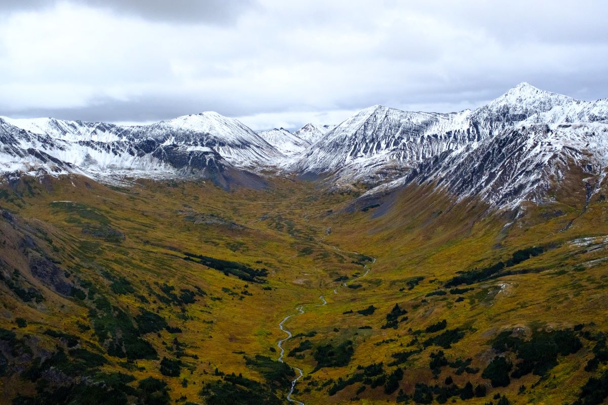
The genesis of our Spatsizi Plateau wilderness adventure happened when we were successfully drawn for a coveted Limited Entry moose and caribou group hunt within the Spatsizi Plateau Wilderness Provincial Park. The plateau’s climate is subarctic in nature and semiarid in many areas because of its high elevation and the mountains and plateaus that protect it from the moisture-laden weather systems rolling in off the North Pacific. This unique habitat, at times referred to as the “Serengeti of the North,” is home to British Columbia’s largest remaining herd of woodland caribou, as well as mountain goats, moose, grizzly bears and wolves.
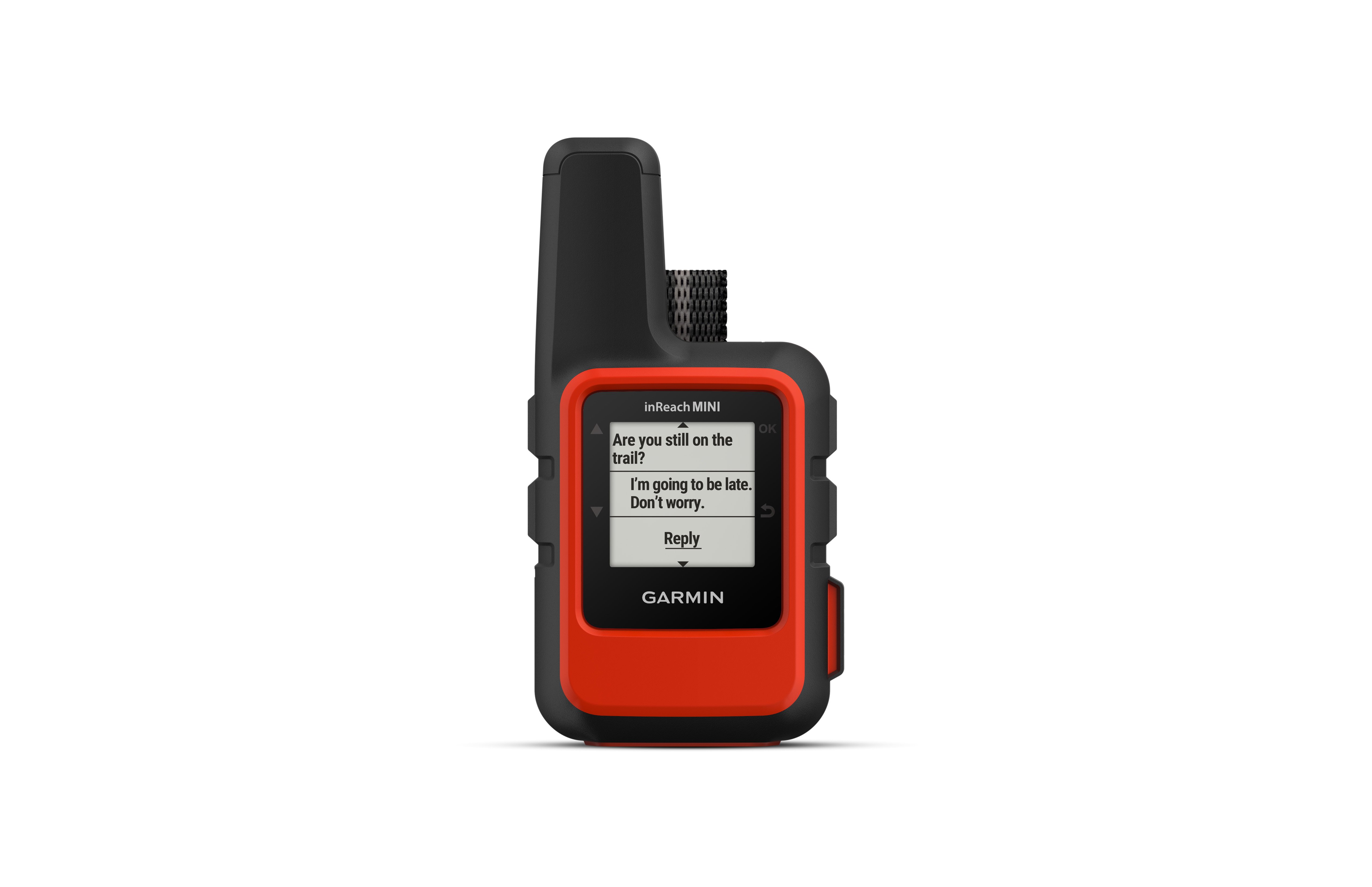
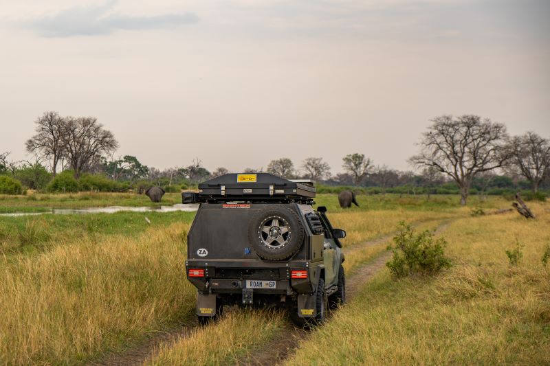
Our trip planning included consultation with B.C. Parks staff, conservation officers and Klappan Air Service’s chief pilot regarding the timing, logistics and gear essential for a safe and successful unsupported expedition in such an isolated and challenging location. At the top of our gear list were communications and navigation equipment. Having explored remote settings globally while leading scientific expeditions, we knew having reliable and effective communications and navigation capability in a wide variety of adverse conditions was critical. The Spatsizi wilderness is prone to extremes in temperature and precipitation, and we would be travelling by canoe and on foot, so everything needed to be fully functional in the cold and wet. Having successfully used Garmin’s inReach® satellite communication technology1 previously, it was our go-to choice to meet both our logistical and safety requirements.
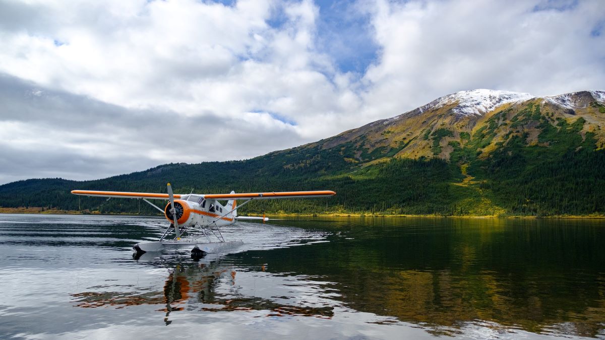
Unseasonably cold, wet weather had been hammering the region for weeks, and we weren’t going to get it any easier. After a day-and-a-half holding for a break in the weather, our pilot, Keith Connors, told us he’d take two of us and a good portion of our 550 kg of gear on the first flight to our base camp, situated on a rocky point of a high elevation mountain lake located deep in the Spatsizi wilderness. Given the highly variable weather we were experiencing, the initial flight was a bit of a scouting mission, checking out which valleys and mountain passes would allow the safest and easiest access to our destination. It is wild, isolated country that doesn’t forgive easily and mistakes can be costly. Having a seasoned pilot and arguably the world’s most capable bush plane, a de Havilland Canada DHC-2 Beaver, transporting us through some of northern Canada’s most remote and challenging mountainous terrain was a confidence builder. They’d both survived the north this long, so we liked our odds.
Our float plane was a 60-year-old battle-hardened veteran of the north, no frills and all business. It had lived a life of hauling food, fuel, equipment and game, as well as hikers, guides, hunters and their prey, in and out of every nook and cranny of northern B.C. that had a beaver pond, lake or river channel long enough to get a Beaver airborne. I noted with interest that our plane was also equipped with Garmin state-of-the-art aviation navigation hardware as well as the latest inReach technology for communications. Our transportation alone required Keith and his Beaver to contend with low cloud cover and limited visibility, as well as icing conditions, freezing rain, snowstorms and squalls with driving rain and high winds. It is a testimony to Keith’s skill and the Beaver’s capability that they were able to safely contend with these flying conditions while transporting large loads of people and gear over high elevation mountain passes and along narrow river valleys, with even an expedition canoe lashed to the pontoons at times.
After shuttling our crew, canoes, food and gear to our base camp, Keith’s Beaver lifted off the frigid lake and into the southerly wind, banking around as it climbed. With a wag of its wings, it disappeared around the neighbouring mountains. The drone of its two-bladed propeller quickly faded in the distance as the cold blast of the ever-present winds picked up and whitecaps emerged on the lake.
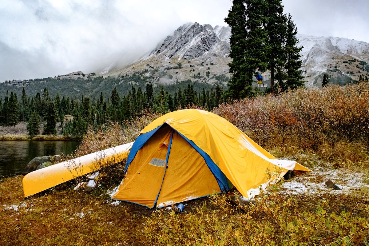
Cold wind, low clouds and near-freezing precipitation were our constant companions, complicating our travel by canoe and access to the high country. The alpine reaches were often socked in, the clouds occasionally parting to reveal ever-increasing snow accumulations. Temperatures hovering around freezing resulted in rain, sleet, hail or snow on a daily basis, regardless of the fact that it was still technically summer. Sometimes we got them all in a single day … or hour! Occasionally, the sun emerged to taunt us with the fleeting pleasure of warm weather while revealing the rugged beauty of the alpine reaches surrounding us. Typically, we woke to near freezing temperatures with snow coating the mountains down to our base camp, which slowly retreated up the alpine slopes as the clouds lifted and the heat of the day warmed the mountains’ southern exposure.
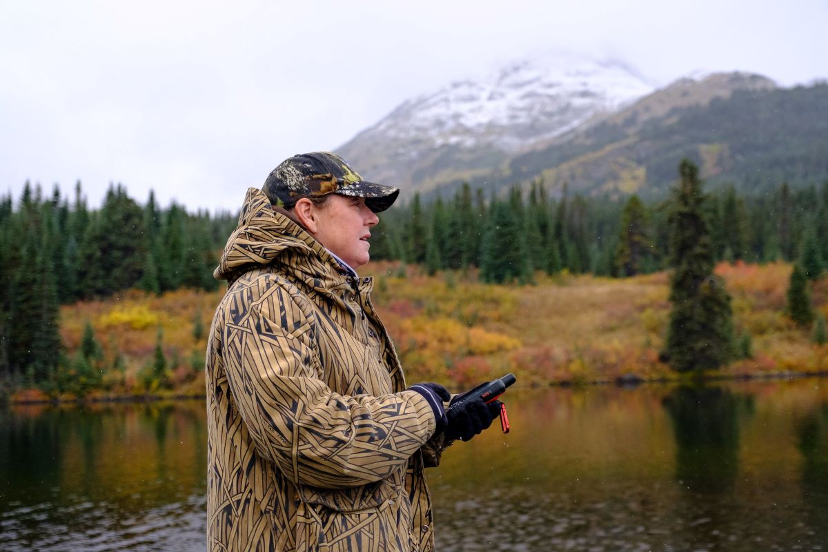
The navigation functionality of the inReach satellite messenger units, especially in combination with the Earthmate® and Explore™ apps, were exactly what we needed as we planned our routes, established waypoints, and tracked and retraced our daily travels. Given that we were often navigating in inclement weather with periods of limited visibility, being able to route find with confidence extended the window we could safely travel each day. Finding our way back to our base camp in the fading light of the day, through snow squalls and high winds, was made easier and safer with these tools.
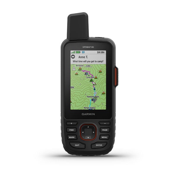
The satellite communication capability of the inReach units, specifically the inReach® Mini and the GPSMAP® 66i, were used multiple times daily as our party connected with one another, Klappan Air Services, Spatsizi River Outfitters “Mountain Shadow” lodge and family members. The devices were in wide use by Klappan Air Services and Spatsizi River Outfitters given the remote region that they operate in, making it easy for us to communicate with them device-to-device, which proved essential as our wilderness expedition progressed.
Our daily dose of wind, rain, low clouds and snow continued both night and day; at one point we found ourselves clearing the snow loading up on our tents at 3 a.m. One feature of the inReach technology system we found particularly helpful was the ability to receive accurate, detailed weather forecasts, specifically for our location, on demand. Understanding the weather conditions we were facing enabled us to plan our daily travels by canoe and on foot with confidence. It also allowed us to best prepare our camp for anticipated wind, rain and snow conditions proactively. Providing effective cover from the rain and snow and building windbreaks were essential elements in establishing a comfortable and functional base camp.
Weather wasn’t the only safety concern to manage — grizzly and black bears are prevalent in this part of the world, and there had been two grizzly attacks in the vicinity of our camp within the previous year.
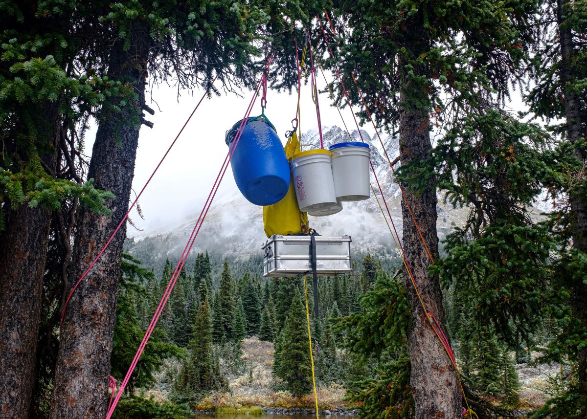
With that knowledge, we organized our camp with well-separated eating, sleeping and food storage areas, our food slung in airtight containers about 15 feet above the ground between two balsam trees. While we were well-equipped with bear spray and other bear deterrent devices, the inReach units added another level of safety, should we need to summon assistance in the event of an aggressive bear encounter. It was a significant enough concern that the local conservation officer, our pilot and Spatsizi River Outfitters all took the time to advise us of the potential risks and discuss mitigation strategies. Out pilot went the extra mile checking in periodically using the inReach system to ensure we were safe and our trip was going well. The reality that this was grizzly country was further reinforced when we discovered big piles of bear scat in the surrounding area.
The ability to receive detailed local weather forecasts on demand turned out to be an essential element of the inReach capabilities. After a week of challenging conditions, we received a forecast that there would be a 2-day break in the weather and then a further 5 to 7 days of high winds with substantial precipitation described as a “heavy winter mix,” predicting significant snow accumulations.
In light of the extended snowfall in the offing and Klappan Air Service’s flight schedule being fully booked moving hunters and hikers out of the bush, Spatsizi River Outfitters suggested that we relocate our base camp 4 kilometers north, where they had an empty hunting cabin adjacent to the lake for us to hole up in and ride out the storm. The next morning, bright and early, we broke camp and readied our gear in dry bags and aluminum boxes to lash in the Clipper expedition canoes for the paddle up the lake. Moving was going to be an all-day event, requiring two round trips for both canoes to move all our gear. We wanted to get at it before the winds picked up, which would make a big job even more challenging.
Just as we were about to launch, we unexpectedly heard the drone of Keith’s Beaver rounding the nearby mountains, before he dropped into the lake in front of our beached canoes. The pilot’s door opened, and he called out that a snowstorm to the south had prevented him picking up other hunters as planned, and he had a short window to get us and our gear out before we’d be snowed in for a week. We quickly loaded several of our party and gear and Keith headed out, skirting cliff sides and snow squalls as he navigated through the Stikine Range and along the Klappan River back to Kluachon Lake.
I opted to stay for the final flight, appreciating the time alone in such a remote, rugged setting. On our return flight, we witnessed the snow loading up in the higher reaches of the mountains, foreshadowing what was soon in store for the rest of the plateau.
Speaking with Keith a week later, he told us his flying had been extremely limited since he pulled us out. He’d battled with winds up to 80 km/hr, heavy snow, freezing rain and very limited visibility as he’d worked to extract others in the backcountry between storm systems. He stated, “You’d probably still be there if we hadn’t got you out when we did!”
At the end of the day, the inReach system’s navigation capabilities were exactly what we needed to safely and effectively route find in a remote wilderness setting. The communications technology was essential to coordinating our travel logistics and keeping folks appraised of our status, as well as providing a significant safety benefit in the case of an emergency. Finally, the ability to receive detailed weather forecasts enabled us to plan our daily activities effectively and make informed logistical decisions for our trip as a whole. Next to the propane heater (have you ever showered on a windy lakeshore at night in a snowstorm?), they were the crew’s favorite piece of kit.
1Active satellite subscription required. Some jurisdictions regulate or prohibit the use of satellite communication devices. It is the responsibility of the user to know and follow all applicable laws in the jurisdictions where the device is intended to be used.